|
|
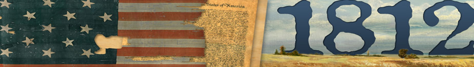
HISTORY OF KNOX COUNTY KENTUCKY
KNOX COUNTY KENTUCKY HISTORY
ELMER DECKER
Who was Elmer Decker? He was a Knox County Lawyer in the late 1930's and early 40's. He studied the History of Knox County and wrote the following manuscript.
When I was growing up in Barbourville. There were people that didn't believe that the Boone Trace followed US 25E. I remember someone that had found marked trees and rocks by Daniel Boone. So at that time a lot of people were interested in the history of Knox County and he was one of the few who left a record of this history.
In 1964 when the present courthouse was built the records were hauled to the dump. And this manuscript is a work of Knox County Records that are now lost forever. If he had not written this we would never know these things about Knox County. It was never published. And the only copy that I am aware of is one that was given to Union College at Barbourville.
By me placing this on the web I hope it will be preserved forever. And will be an honor to Elmer Decker. I am not any part of his family nor am I kin to him. I just believe that someone should preserve this record for future generations to come.
I hope that you find it as interesting as I have. Spelling is original. The orginal manuscript was typed on legal size paper and had a few pages of tables showing how many kids where in each school and how much the state paid each school for those pupils, no names where included and beening a home made form I couldn't type these. So the page numbers are different on this copy from the orginal.
If you would like to have a copy of this on cd with a search engine it can be bought for a tax deductable contribution of $25.00 plus shipping, from:
Bell County Historical Museum
PO Box 1344
Middlesboro, KY 40965
(606)242-0005
email Bell Historical Society
C. Richard Matthews
INTRODUCTION
At one time or another England, France, and Spain claimed various portions of North America, including Kentucky.
It is not definitely known when any part of the State of Kentucky was first visited by white men. French colonists in Canada and Louisiana traveled the Mississippi and Illinois River routes passing Kentucky. Later the French came down the Ohio River from Ft. Duquesne (Pittsburg).
These early explorers did descend the Mississippi River and passed Kentucky enroute. There are few authentic records of their ever landing on Kentucky soil. Louis Hennepin, a Catholic Priest, descended the Mississippi River and visited Kentucky in 1680. LaSalle and Captain Tonti trod Kentucky soil in 1682. In 1685 and 1688 Captain Tonti again visited West Kentucky. In northern Kentucky, near Limestone (Maysville), the Indians built log houses, which apparently, the French occupied at different times.
In 1584 Sir Walter Raleigh, under an English patent, tried unsuccessfully to settle a colony. His charter included Kentucky.
The charter of the Jamestown Colony, commanded by Captain John Smith and first settled in 1607, also included Kentucky.
At Albany, New York in 1684?, a treaty with the Iroquois by Lord Howard, Governor of Virginia, and Colonel Dungan, Governor of New York, deeded to the British Government a vast tract of country, which embraced Kentucky.
On November 5, 1768, another treaty, made at Ft. Stansix, between the Six Nations and the Delawares, Shawanees, and Mingoes of Ohio and King George III of England, included the sale of a large tract of land in which was Kentucky.
Following the Battle of Point Pleasant, October 10, 1774, which was called the first battle of the American Revolution, the Shawanee Indians made a treaty with lord Durmore, Governor of Virginia, relinquishing all claim to lands south of the Ohio River.
There were other and later treaties with the Cherokees and Chichasaws conveying parts of Kentucky.
Thus it can be said that the Colony and State of Virginia had claim to Kentucky. This claim was generally recognized by the other colonies and states. This led to exploration parties from Virginia.
The first English settlers, captured by the Indians, to enter Kentucky were Gabriel Authur, 1674, John Salling, 1730, John Howard, 1742, and Mary Draper Ingles, 1755, who was the first white woman in Kentucky.
3
Dr. Thomas Walker, of Albermarle County, Virginia, on behalf of the Loyal Land Company, commenced a journey to Kentucky March 6, 1750. That part of his journal relating to early Knox County follows:
April 13th. We went four miles to a large creek, which we called Cedar Creek, being a branch of Bear Grass, and from thence six miles to Cave Gap, the land being level. On the north side of the gap is a large spring, which falls very fast and just above the spring is a small entrance to a large cave, which the spring runs through, and there is a constant stream of cool air issuing out. The spring is sufficient to turn a mill. Just at the foot of the hill is a Laurel Thicket, and the spring water runs through it. On the south is a plain Indian road. On the top of the ridge are Laurel Trees marked with crosses, blazed and several figures on them. As I went down the other side I soon came to some Laurel on the head of a branch. A Beech stands on the left hand, on which I cut my name. This gap may be seen at a considerable distance, and there is no other, that I know of, except one about two miles to the north of it, which does not appear to be so low as the other. The mountain on. the north side is very steep and rocky, but on. the south side it is not so. We called it Steep Ridge.
At the foot of the hill on. the northwest side we came to a branch that made a great deal of flat land. We kept down it 2 miles. Several other branches come in to make it a large creek, and we called it Flat Creek. We camped on the bank where we found very good coal. I did not see any Limestone beyond this ridge. We rode 13 miles this day.
April 14th. We kept down the creek 5 miles chiefly along the Indian road.
15th. Easter Sunday. Being in bad grounds for our horses we moved 7 miles along the Indian road, to Clover Creek. Clover and Hop Vines are plenty here.
April 16th. Rain. I made a pair of Indian Shoes those I brought being bad.
17th. still rain. I went down the creek a hunting and found that it went into a river about a mile below our camp. This, which is Flat Creek and some other join'd, I called Cumberland River.
THE CUMBERLAND
A long thin line of Turquoise blue,
With tints in the sky of self-same hue,
The hills of purple, gray and green
Were enrapt in a golden sheen,
Majestic hills, river between,
The Cumberland rolls on.
From Letcher's rocks and rills it leaps,
Past miner's camp and home it sweeps,
Through Tennessee it flows along,
4
God's melodies it does prolong,
Melody grand, infinite song,
The Cumberland rolls on.
Down through the hills its crystal waves,
An everlasting roadway paves,
A path to nature's mysteries,
Path to appointed reveries,
Reveries sweet, mysteries deep,
The Cumberland rolls on.
Through a haze shrouded lane of time,
And beautiful nature sublime,
While the toilsome strife of ages,
Turns over history's pages,
Honor ages, shimmer pages,
The Cumberland rolls on.
Rippling always a merry song,
'Neath a brave empire building throng,
Leaping, laughing, singing along,
Never is the melody wrong,
Musical dream, heavenly stream,
The Cumberland rolls on. Elmer Decker
18th. Still Cloudy. We kept down the creek to the river along the indian road to where it crosses. Indians have lived about this ford some years ago. We kept down the south side. After riding 5 miles from our camp, we left the river, it being very crooked. In riding 3 miles we came on it again. It is about 60 or 70 yards wide. We rode 8 miles this day.
19th. We left the river but in 4 miles we came on it again at the mouth of Licking Creek. Which we went up and down another. In the fork of Licking Creek is a lick much used by Buffaloes and many large roads lead to it. This afternoon Ambrose Powell was bit by a bear in the knee. We rode 7 miles this day.
20th. We kept down the creek 2 miles to the river again. It appears not any wider here than at the mouth of Clover Creek, but much deeper. I thought it proper to cross the river and began a bark Canoe.
21st. We finished the canoe and tried her. About noon it began to thunder, lightening, hail and rain. It continued about 2 hours.
22nd. The Sabbath. One of the horses was found unable to walk this morning. I then propos'd that with two of the company I would proceed. And the other three should continue here, until our return, which was agreed to, and lots were drawn to determine who should go. Ambrose Powell and Colby Chew were the fortunate persons. William Tomlinson, Henry Lawless and John Hughs remained.
23rd. Having carried our baggage over in the bark canoe and swam our
5
horses, we all crossed the river. Then Ambrose Powell, Colby Chew and I departed. Leaving the others to provide and salt some bear, build a house and plant some Peach Stones and corn. We traveled about 12 miles and camped on Crooked Creek. The mountains are very small here abouts and here is a great deal of flat land. We got through the cold today.
April 24th. We kept on westerly 18 miles, go clear of the mountains and found the land poor and the woods very thick beyond them, and Laurel and Ivey in and near the branches. Our horses suffered very much here for want of food. This day we came on the fresh track of 7 or 8 Indians, but could not overtake them.
25th. We kept on west 5 miles, the land continuing much same, the Laurel rather growing worse, and food scarcer. I got up a tree on a ridge and saw the growth of the land much the same as far as my sight could reach. I then concluded to return to the rest of my company. I kept on my track 1 mile then turned southerly and went to the Cumberland River at the mouth of Clover Creek. Rocky Creek runs within 40 yards of the river bank then turns off, and runs up the river, surrounding about 25 acres of land before it falls into the river. The banks of the river and creek mouth of the creek is an Ash mark'd T.W., a Red Oak A.P., a White Hiccory C.C. besides several trees blazed several ways with 3 chops over each blaze. We went up the north side of the river 8 miles and camped on a small branch. A bear broke one of my dogs forelegs.
April 27th. We crossed Indian Creek and went down Meadow Creek to the river. There comes in another from the southward as big as the mouth are the remains of several Indian cabins and amongst them a rough hill made by Art about 20 feet high and over 60 over the top. We went up the river, and camped on the bank.
28th. We kept up the river to our company whom we found all well, but the lame horse was as bad as we left him and another had been bit in the nose by a snake. I rub'd the wounds with bears oil, and gave him a drench of the same and another of the decoction of Rattle Snake Rott some time after. The people I left had built a house 12 by 8, clear'd and broke some ground, planted corn and Peach Stones. They also had killed several bears and cured the meat. This day Colby Chew and his horse fell down the bank. I bled and gave him Volatile Drops and he soon recovered.
April 29th. The Sabbath. The bitten horse is better. 3 quarter of a mile below the house is a pond in the low ground of the river, a quarter of a mile in length and 200 yards wide much frequented by fowl.
30th. I blazed a way from our house to the river. On the other side of river is a large Elm cut down and barked about 20 feet and another standing just by it with the bark cut around at the root and about 15 feet above. About 200 yards below this is a white Hickery barked about 15 feet. The depth of the water here, when the lowest that I have seen it, is about 7 or 8 feet, the bottom of the river sandy ye banks very high and the current very slow. The bitten horse is being much mended, we set off and left the lame one. He is white, branded on the rear Buttock with a swivil stirrup iron, and is old.
6
We left the river and having crossed several hills and branches, camped in a valley north from the house.
May the lst. Another horse being bit, I applyed bears oil as before mentioned. We got to POWELL's River in the afternoon and went down it along an Indian road, much frequented, to the mouth of a creek on the west side of the river, where we camped. The Indian road goes up the creek and I think it is that which goes through Cave Gap.
2nd. We kept down the river. At the mouth of a creek that comes in on the east side is a lick, and I believe there was a hundred Buffaloes at it. About 2 o'clock we had a shower of rain. We camped on the river, which is very crooked.
May 3rd. We crossed a narrow neck of land, came on the river again and kept down it to an Indian camp, that had been built this spring, and in it we took up our quarters. It began to rain about noon and continued until night.
4th. We crossed a narrow neck of land and came on the river again, which we kept down till it turn'd to the westward, we then left it, and went up a creek which we called Colby's Creek. The river is about 50 yards over where we left.
5th. We got to Tomlinson's River, which is about the size of Powell's River, and I cut my name on a Beech, that stands on the north side of the river. Here is plenty of coal in the south bank opposite to our camp.
6th. The Sabbath. I saw Goslings, which shows that wild Geese stay here all the year. Ambrose Powell had the misfortune to sprain his well knee.
7th. We went down Tomlinson's River the land being very broken and our way embarrassed by trees, that had been blown down about 2 years ago.
May 8th. We went up a creek on the north side of the river.
9th. We got to Lawlesses River which is much like the others. The mountains here are very steep and on some of them is Laurel and Ivey. The tops of the mountains are very rocky and some parts of the rocks seem to be composed of shells, nuts and many other substance petrified and cemented together and with a kind of flint. We left the river and after traveling some miles we got among trees that had been blown down about 2 years, and were obliged to go down a creek to the river again, the small branches and mountains being impassable.
This the first authentic account of a house been built by Englishmen in the Commonwealth of Kentucky. The site is about six miles below Barbourville on the north side of Cumberland River near Swan Lake.
Corn and peach stones were first planted by white men during Dr. Walker's
7
journey. He didn't name the mountains or the gap. He called it Steep Ridge and left it Steep Ridge. The gap was named by one Wallen or Walden, a long hunter, after his native Cumberland County, Virginia. Indians called Cumberland Mountain Ouassioto, or Wasseoto. On early maps Cumberland River is called Shawnee.
The house site of Dr. Walker was acquired by Deaton-Smith Post No. 69, the American Legion, and donated to the Kentucky Park Commission.
In 1751, Christopher Gist commenced a trip of exploration from the "Old Town on the Potomack River in Maryland." Gist may have touched the north tip of old Knox County. However, since he returned home up the north fork of the Kentucky River it is not thought that he was on Knox County soil.
A party of long hunters, so called because they remained away from the settlement on hunts for twelve months or longer. Skaggs, Newman, Blevins, Cox and Wallen (for whom Wallen's Creek in Harlan County is named), entered Kentucky Cumberland Gap (it belonged to Kentucky until 1859, Tennessee archives) in 1761.
In 1766 Captain James Smith, who later settled in Bourbon County, Joshua Horton, Uriah Stone, Wm. Baker and a mulatto slave came through the gap.
From South Carolina in 1767 Isaac Lindsey, who is said to have named Rockcastle River, led a party through the gap toward the central part of the state. During this year John Findlay made a trip beyond Cumberland Mountain.
Daniel Boone, piloted by Finley, made his first trip to and through Cumberland Gap in 1769. He later made several trips, and in 1775 blazed the famous trace.
Another band of long hunters, James Knox, John Rains, Kasper Mansco, Abraham Bledsoe, John Baker, Joseph Drake, Obakian Terrell, Uriah Stone, Henry Smith, Edward Cowan, Thomas Gordon, Humphrey Hogan, Cassius Brooks, Robert Crockett and others came to Kentucky through Cumberland Gap in 1769.
On March 17, 1775, Colonel Richard Henderson, Nathaniel Hart and others bought a track of land from the Cherokees, which included the territory in Kentucky between the Ohio, Kentucky and Cumberland Rivers, as far east as the Cumberland Mountain. It was called Transylvania Colony. Lord Dunmore, Governor of Virginia, refused to recognize the colony and the trade with the Indians, but assumed the benefits and granted the buyers a tract of land twelve miles square on the Ohio below the mouth of Green River. It was for Henderson, Hart and Company that Daniel Boone blazed the Trace, later known as the Old Wilderness Road.
Within the bounds of the present City of Middlesboro, (according to the late Judge Aires of Pineville), was made the first entry of land that was made under any title in southeastern Kentucky, and the first that was made in Kentucky under the title of Richard Henderson and his Associates.
8
On the back of the first page of his journal, April 3, 1775, Richard Henderson entered Bryce Martin for 500 acres of land lying on the first creek after crossing Cumberland Gap. The next entry of any size, made by Virginia authorities, was that to Colonel Arthur Campbell, called the father of Washington County, Virginia, for 600 acres on Flatt (yellow) Creek in 1780. One Henderson made this survey for Col. Campbell. Richard Davis and Samuel Mosby carried the chains.
Bryce Martin was a brother of Joseph Martin, who established the first ferry across the Cumberland River on the Warrior's Path near the ford (Pineville, the ford was at the foot of Laurel Street - the ferry was between there and the Wallsend Bridge), in 1791. This is the same Joseph Martin who built Martin's Station, near the present town of Rose Hill, Virginia and for whom Martin's Fork of the Cumberland River is named.
At Harrodsburg on. June 6, 1775, a general meeting chose George Rogers Clark and Gabriel Jones as agents to the Virginia Assembly. Whether this Gabriel Jones, who was a Captain in the Virginia Militia and was later killed in a disastrous engagement with the Indians between the Blue Licks and Ohio River on the Old Limestone Trail, was of the Gabriel Jones who later settled in Knox County is not known. A Gabriel Jones was granted a certificate by the Knox County Court, for 400 acres of land below the mouth of Cranks Creek in 1801 "by virtue of an actual settlement made thereon."
The first legislative body west of the Allegheny and Cumberland Mountains met at Boonesborough, May 23, 1775. The second legal, (the first was a court of and claims at Harrodstown in 1779, composed of four commissioners, William Fleming, Edmund Lyne, James Barbour and Stephen Trigg), ever held in Kentucky was for Lincoln County, parent of Knox, Bell and other southeastern counties. It was organized at Harrodsburg, January 1781. Logans, Bowmans and Craigs were appointed to office by the Governor of Virginia. John Logan Jr., prominently identified with the early history of Knox County was from Lincoln County and later returned there.
Kentucky had always been a part of Virginia from early Colonial times. Orange County organized in 1734, embraced all Virginia territory west of the Blue Ridge. Augusta County was formed from Orange in 1738 and organized in 1745, Bottetourt formed from Augusta in 1769, and Fincastle was formed from Bottetourt in 1772, all of these included Kentucky.
On December 31, 1776, Kentucky County was formed. Kentucky was a county before it was a state. This county was subdivided in 1780 into Jefferson, Fayette and Lincoln Counties.
From 1780 until the admission of the state into the Union. the name Kentucky was not on the map except as the name of a river.
In March 1783, Kentucky was formed into one district. A district court was opened at Harrodsburg, March 3, 1783, by John Floyd and Samuel McDowell as judges.
9